Archive for the 'Motorcycling' Category

Canyon Run 2007 – Day 3

Monday, May 14th, 2007

A mere 220 miles today, and we ended up in yet another ski town.

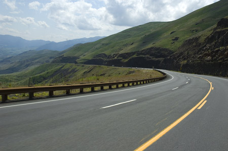
We were actually ready to roll by 9:30 but first we had to seek out a replacement pair of headphones for Willo and a small dry bag (too much stuff for the saddlebags). The first 20 or 30 miles heading south from McCall were pleasant enough – green and a lot of straight, with occasional curves. This part of Idaho is a broad valley at about 5000 feet between two mountain ridges. In spring the valley is lush with grass, and very satisfying to look at.

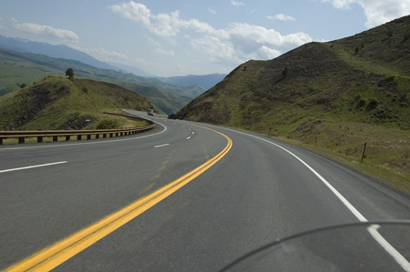
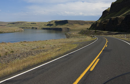
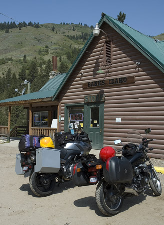
After the town of Smith’s Ferry the road gets a lot twistier as it follows the tumbling Payette River, with corners rated as slow as 30 mph (“rated” I said – not that we went 30). 60 miles from McCall we turned east at Banks (home of the Banks Store, where signs complain about the number of non-customers using the bathroom – Willo bought a V-8 so I didn’t feel so bad, but they definitely have bathroom issues in Banks).

The Banks Store

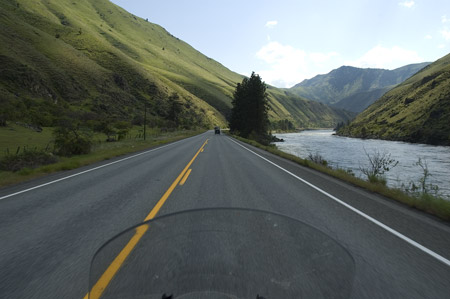
Riding east from Banks, the road follows an even steeper valley with another plunging river in the bottom. Last year on this section we ran into many small rockslides on the road. This year there were only a couple. We stopped in well-named Garden Valley at another traditional lunch spot – the Runaway Bear (according to the restaurant sign, the bear is being chased by bees – that’s why he’s running). The food was mostly interchangeable with any other roadside joint, but the Hungry Bear does offer something unique in the form of tater tots – delicious!

This got me wondering about how tater tots are made. It’s too much to expect they are individually hand formed, and they seem too naturally rough to have been extruded from a tube and sliced. Note to self: research tater tot manufacture.

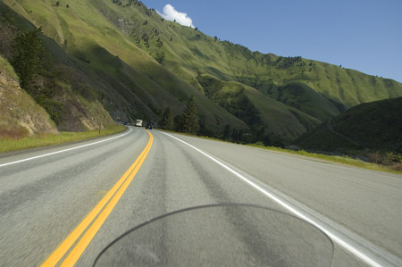
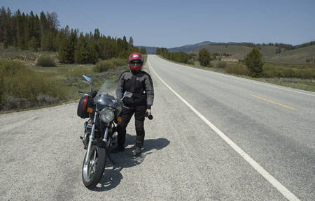
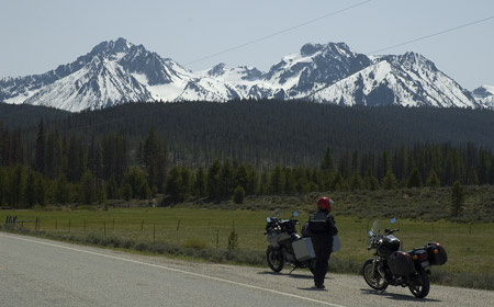
After lunch we rode another 75 miles to Stanley, the last stop before Sun Valley. Last year we didn’t come through this section until well after dark (with temperatures in the 30s). This year it was warm and sunny. The Stanley area features the dramatic Sawtooth Mountains – similar to the Tetons in that they poke straight up with few intervening foothills.

Outside Stanley

Sawtooth Mountains

Another 30 miles brought us to the twisting climb up to Galena Summit, at 8700 feet. Two years ago on the way south there was snow on Galena and we had to detour 200 miles (in pouring rain). Today it was… sunny and warm (this is a theme). The road over Galena is a lot of fun, though we got stuck behind an SUV for most of the twisty part on the way down. Sometimes I wonder if it wouldn’t just be better to pull over and wait – let them get ahead and then play until we catch up again. Rinse and repeat. Maybe someday.

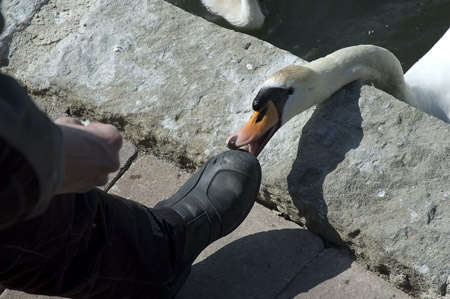
Another 20 miles brought us to Sun Valley, playground of – whoever plays here. That would include swans – the Sun Valley lodge has a small herd of swans they use to threaten the children of guests. Here is one of the boot-eating swans working on Willo:

Boot-eating swan

We’re now basking in the sun, sipping espresso and listening to DeBarge on the ice rink sound system. What more could you ask for?

Canyon Run 2007 – Day 2

Sunday, May 13th, 2007

Today was relatively short in terms of mileage – about 260 for the day – but we lost an hour due to the change in time zones. We’re now on Mountain Time.

We left Dayton at about 9:15. The weather was cool and very windy, but the sun was out. As we wound east through more dramatic rolling hills, the wind would occasionally gust strongly enough to force us to lean over sharply to compensate. I thought it was fun. Willo however did not, especially when a particularly strong gust caught her magnetic tank bag and flipped it off her gas tank and into the road (at about 70 mph), taking her iPod with it and jerking her earphones out. I was riding ahead and when I noticed she wasn’t in my mirror I pulled over and waited, figuring she was adjusting something. After about 10 minutes “something bad happened” started to outweigh “nothing bad happened” and I rode back to check. Of course she had it all together by then so we passed each other, and I turned around again and caught up. The top of the tank bag got pretty scratched up and the earphone wires are living on borrowed time but the iPod survived. We will be on the lookout for a new set of earphones.

In Idaho we took the longer, more scenic Highway 12 along the Clearwater River to our usual lunch stop at Grangeville. The hills on either side of the river climb at almost exactly 45 degrees, and are covered with rich green grass spotted with trees and rock outcroppings. Add a few elves and leprechauns and you have a textbook fairyland. Right before Grangeville is an absolutely fantastic tight twisty ascent – about three miles of 20-mph-rated curves that we ended up doing about 45 through, with a lush valley off to the left. We were both grinning when we stopped for lunch.

Following lunch we climbed over White Bird Summit and then descended to the Salmon River – 8 miles of sweeping 7-8% grade:

Descending from White Bird Summit

Descending from White Bird Summit

At the bottom, the Salmon river repeats the fairyland vibe of the Clearwater, though on a smaller scale:

Salmon River

Salmon River

Another 70 or so miles brought us to tonight’s stay in McCall, Idaho. McCall is a ski town serving the Brundage ski area, and is situated on Payette Lake in central Idaho. Apparently May is the shoulder season here, and Sunday night is the “shoulder” night, as everything was closed. We finally got a kind referral to a good restaurant – Babblefish – at the Mile High Marina on the lake. Despite the fact that they tend to shut down in the spring and fall, we often try to stay in ski towns when on the road. They usually have nicer, cleaner accommodations and better dining options, and room rates can be heavily discounted during slow times.

Here is Payette Lake on another trip through the area:

Payette Lake

Canyon Run 2007 – Day 1

Saturday, May 12th, 2007

Got a leisurely start today, rolling out about 10 am. We knocked out 100 quick miles on I-90 over Snoqualmie Pass, taking our first break at the rest area between Cle Elum and Ellensburg. The ride through the pass was beautiful. Clear and sunny but pleasantly cool. We stuck to the fast lane, keeping between 70 and 80 most of the time. The VStrom felt good but the steering was a bit light and there was a tendency for it to wallow in the turns. I figured this was probably due to the ridiculous amount of stuff on board – especially the dry bag full of clothes strapped high and back on the rear rack. When we stopped I added one step of rear preload and half a turn more damping to the rear, and that shaped things up nicely.

We stopped for lunch in Vantage, next to the Columbia River. The no-frills diner sported about 40 Harleys in the parking lot, but no apparent riders in the restaurant. Mysterious, until we realized they were all in the bar in the back. This was probably a good thing – the beer will help them ignore the pain when they take a slide in their tank tops and buttless chaps. (No judgment here!)

After lunch we turned south along the Columbia, then east at Mattawa for 35 miles of ultra-straight, hot and boring. As we ventured further east the curves began, and finally we arrived at one of our favorite roads, the asphalt roller coaster between Kahlotus and Starbuck. It’s actually better going south-to-north, because the first part climbs and twists sharply for about half a mile – fun when you’re going up, not as fun when you’re going down, trying not to sail off the edge…

We pulled off the road and I decided to go back for a few photos of the river. Unfortunately, the place we pulled off had gravel that was, in places, 8 inches deep. Willo almost made it through, but ended up plowing her front end and tipping over. Righting the bike was a challenge in the deep gravel – the wheels kept squirting out from under – but we got it up eventually and wrestled it onto firmer ground. No damage, just a few scratches on the saddlebag.

The Snake River, near Lyon's Ferry State Park

We ended up in Dayton, WA, with about 280 miles under our belt for the day. Dayton is the heart of Columbia County and part of an area known as the Palouse. This area features dramatic rolling hills covered with grain fields all in different stages of growth. Naturally the roads twist and turn as they make their way around these hills. It’s a beautiful place to ride.

More to come…